Ulster
Category: Land + PeopleEast Ulster
By T. W. Freeman
This region is inhabited by almost one-quarter of the population of Ireland, and forms, in the three counties of Antrim, Down and Armagh, half the governmental province of Northern Ireland. Nearly half its people live in Belfast, since 1921 a capital city as well as Ireland’s greatest industrial town, but the heart of Ulster is its farmed countryside, which was settled, mainly in Stuart times, by immigrant Scots and to a lesser extent by English, who have given most of the country its distinctly Protestant way of life and outlook, though the descendants of the Catholic Irish or Scots from the western isles predominate in such areas as the Glens of Antrim, south Down and south Armagh, and form a substantial minority almost everywhere else. East Ulster is a country of careful farming and industrial towns.
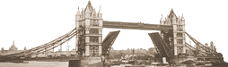
Over almost all the area, the rural landscape prevails, and even Belfast, though grimer than Dublin, is in no sense a Black Country, for less than three miles from the City Hall there is open country over 1,000 ft. high and on the east side of the city the transition to a farmed countryside is almost equally sharp. Placed on the reclaimed land around the Lagan, the raised beaches, and the low ridges between the rivers, Belfast has become the great economic and political focus not merely of three counties but of all the territory now known as Northern Ireland. The rise of Belfast to the status of a major city within the past hundred years is the most significant of many geographical changes within the period.
All the three counties Antrim, Down and Armagh still have less than one-third of their population in towns and are, in spite of numerous factories, almost as distinctly rural in their life as the rest of Ireland.
Physically the Lough Neagh lowland is apparently designed by nature to draw travellers from many sources by road and rail to its focus in Portadown or to the ancient and dignified ecclesiastical capital Armagh. But Belfast is now a focus of more economic and administrative importance than either of these and therefore the Ulster Basin is merely a passage-way having no regional capital even though it is densely populated, intensively farmed, and of some industrial importance.
Two rivers, the Blackwater and the lower Bann, with Lough Neagh between them, provide a possible western boundary for this region- These rivers still separate the closely settled east of Ulster from the less intensively occupied west. But no clear southern boundary exists. When the six counties were separated from the remaining twenty-six, it was not intended that the Border should retain its present position, and the British Government set up a commission to make a readjustment based on social, including economic and geographical, factors.
The Report of the Commission was ready in 1925 but never published or implemented: therefore, the Border has itself acquired sufficient importance in the life of the region to be, in human terms, a major geographical and economic divide, which one is obliged to accept as a southern limit for the region.
West Ulster
West Ulster, in its fullest extent, is the country of hills and lowlands that extends from the river Bann to the treeless shores of the Atlantic in Donegal; so viewed, it is the basin of the Foyle and the Strule, together with various smaller river valleys approached by passes through cols in the hills that surround the basin. Londonderry town is its natural focus and the Foyle its great artery of commerce by river, road and railway.
Any border would be difficult to establish in an area such as West Ulster, which is essentially a passage land, physically of some complexity but consisting primarily of lowlands through which roads and railways are engineered with little difficulty and agricultural settlement is continuous, except in the Sperrin mountains and a few lesser uplands. There is here no desolate waste available to separate Northern Ireland from Eire and therefore the political division rests on an assessment of differences in outlook, based partly on religion. But the divergences here do not enable a sharp line to be drawn as Roman Catholic and Protestant communities are so completely intermingled that any line of demarcation would be unsatisfactory even if one accepts as in general tendency true the widespread assumption that in this region Roman Catholics desire a united Ireland and that Protestants wish to remain within the United Kingdom.
In West Ulster the impact of industry has been less sharply felt than in East Ulster, yet the agricultural life shows elements of the same intensity, with small farming units having a substantial acreage of arable crops, except in Co. Fermanagh where dairying and stock rearing depend mainly on grasslands.
All the various hills of West Ulster have gently rounded outlines with long smooth peat-covered sides, and are traversed by valleys generally wide and open but including some deep glens.
Over the greater part of its course, the Erne spreads into a maze of waterways called lakes for convenience: thus the two Erne loughs are separated only by the river crossing at Enniskillen and the upper Erne lough is divided only by a few miles of complex waterways. All these lakes have numerous islands and peninsulas and in effect form one vast sheet
of water between various drumlins and low hills: around them is an extensive network of bog and alluvium in which a number of “loughlets” exist.
Communications in West Ulster follow the various river routes: of prime importance is the Foyle, with Londonderry as its port and natural market centre.
The West Ulster landscape is essentially agricultural and the patches of mountain or lowland bog or of woodland appear as little more than an occasional interruption of the farmlands. The fields are generally small and the landscape shows the fragmentation that is also characteristic of East Ulster and indeed of the whole northern sector of Ireland.
Londonderry city stands as the one regional capital in the west of Ulster. Its very distance from Belfast, over seventy miles by rail or road, combined with the lack of any nearer competing town of comparable size, assures it of some economic strength. The city of Londonderry (Derry) is a town of great antiquity, built on a hilltop over 100 ft. higher than the Foyle, here 300 yards wide. This hill is surrounded by the Mary Blues Burn, an old channel that is still below the level of high water at spring tides, which are kept back by retaining walls. The nucleus of the town is the old walled city with its Cathedral built in 1633 on the site of an earlier church, and its stately eighteenth-century buildings. Londonderry profits comparatively little from its nearness to the Atlantic as the commercial strength of Belfast is incomparably greater. Nevertheless, it remains the regional capital of the northwest and small as it may seem, is still the fourth town of Ireland, (p. 535)
The Foyle-Strule Valleys
The Strule and the Foyle together form the main north- south stream of this large basin and receive a number of important tributaries which join the river at right angles on each side. The farming is mixed with at least half the land in permanent pasture and the remainder used chiefly for hay in the south, but for crops, especially oats and potatoes, farther north. Sheep are kept in large numbers only near the mountains.
From Ireland, London, 1950.